Kancamagus Highway

An open road well balanced with caffeine, gasoline and love can take you a long way, literally! Add in an exuberance of fall foliage around it while the sun shines brightly above; it is a recipe for a good day at work.
As residents of the New England area, fall is a particularly exciting season for us. Not only because of the impending winter right after, but also because of the scenery around you along with the festivities that springs to life. Perfect time to hit the road on a sunny weekend for a day or a weekend getaway. Among several others, Kancamagus highway in New Hampshire White Mountains is a particularly special one. It is an easy ride with enough hikes to keep you exercised and quick enough to cover in a 7-8 hour day for a New England resident.
Begin At: Conway, NH | Suggested Duration: 5 Hours | Recommended Time of Visit: Fall (Mid-Sept – Mid-Oct)
We will take you through our journey along with some key tips to make this road trip memorable. Scroll down for a Google Maps view of the highway, but here is a snapshot of the official map –

Official Kancamagus Highway Map
We begin the road trip from the visitor center in Conway, NH in the eastern most side of the Kancamagus Highway. Follow the map for planning purposes.
Brief History
The name Kancamagus comes from the peace loving tribal chief of the legendary Indians, Passaconaway, of New Hampshire. European settlers lived in the fertile land along the Swift river in 1790. The road connecting Conway and Lincoln was established and opened to traffic in 1959. Now US Forest Service maintains the road and recreational areas, that support hiking, skiing, swimming and kayaking. Trails and overlooks provide ample opportunity for visitors to hike and soak in the panoramic vistas of the Kancamagus mountains and the valleys.
Scenic Route
There are multiple scenic spots along the way. Mileage from the Eastern Entrance is marked below.
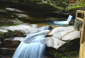
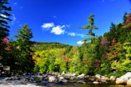
- First Leg: The Swift river runs along the Kancamagus Highway. The main attractions and vantage points are mostly along the river. The first stop to the right is the Albany Covered Bridge (6.1 miles), followed by the Lower Falls (6.8 miles), both of which requires a quick hike. Rocks and boulders in the river allows you to take a better look at the valley up and down stream. On a clear day, foliage colors and the rocky foreground makes for beautiful landscape pictures. The viewing platforms for the Lower Falls make great pictures while appreciating the serenity around. Next up is the Rocky Gorge (9.0 miles) that is a highly photogenic area with a beautiful flume and falls. On your way westward, stop at the Russel Colbath House (12.5 miles) which is a historic house retaining the remains of the Passaconaway village. Before reaching the pass, on your left will be the Sabbaday Falls (15.4 miles)
which requires an easy 0.6 mile hike to the cascading falls and an emerald pool.
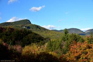
- Crest: Through the winding roads alongside bright foliage, the road took us to about 3,000 feet high at the Kancamagus Pass (22 miles). There are multiple vantage points facing east and west; feel free to pull over cautiously to soak in the views of the valleys that boast a palette of mixed hues. Notable overlooks, before
and after the Kancamagus Pass, are Sugar Hill Overlook (17 miles), CL Graham Overlook (21 miles) for views of the Northeast. Best viewed in the afternoon with the sun in the back.
- The Descent: Once past the pass, the road becomes slightly narrower and more winding while you descend. There are overlooks to view the south and southwest sides now. Pemi Overlook (23 miles) and Hancock Overlook (24 miles) provide
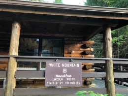
unobstructed views of the Osceola range. Last notable stop is at the Lincoln Woods (30 miles). A suspension bridge and a fairly long hike on mostly flat terrain should make your day complete. Fall foliage colors might be a bit subdued here due to the presence of conifers.
- Down and Out: On your way out to Lincoln, there ought to be a quick stop at the Loon Mountain Ski Resort for some stunning views, especially at dusk. Although a tiny town, stop at Lincoln for a quick bite. The Gypsy cafe, (dog friendly) with its whimsical menu of interesting selection of cuisine from around the world, is our favorite.
Key things to know before you go
- Although you can visit any time of the year, fall makes it the poster child of NH tourism. Timing the visit to experience the explosion of colors at its peak, however, is tricky. Leaves begin to turn at the higher altitudes first. Leaves reach the peak color at the lower altitudes about 1-2 weeks after peaks at the high altitudes. So at any given time, barring about a 8-10 day window, either the high altitudes or lower altitudes will not be at peak. Since the Kancamagus highway strategically goes through both altitudes, you should be able to see a spectrum of color regardless.
- It is close to impossible to predict what time the colors reach peak, so unfortunately for travelers coming in from outside New England, it is a gamble. As it gets closer to the middle of September, however, foliage tracking is a bit more predictable. Check these two amazing resources to fine tune your timing – NH Foliage Tracker and New England Live Foliage Map.
- Kancamagus Highway is the road between Lincoln, NH (in the west) and Conway, NH (in the east). You can enter from either side, but going from East to West has its benefits. First, likely you are going to finish the trip in the evening just before sunset. The glow is best observed from the hikes in the western end. Also, the attractions in the eastern side are better observed during the day. Finally, Lincoln is a quaint town for dinner and is closer to a major highway connecting to Boston.
- There is no cellphone reception after you cross the visitor center in Conway, NH. So pick up a map from the visitor center. It is fairly easy to navigate as the hikes and attractions are well marked.
- Quite obvious, but please adhere to the speed limits. The road is not treacherous, but bicyclists and wildlife frequent this road. While you admire the fall foliage, please keep an eye on the bicyclists and wildlife.
- There are no food or beverages sold in the 35 mile stretch between Conway and Lincoln. So pick up some food/lunch from Conway that you can eat in the picnic benches along the way.
- There are no gas stations along the way, and gas prices are high in Lincoln. So fill up the tank before entering the road.
Interactive Map
Feel free to use the downloadable map below for your Kancamagus expedition.


great info…we’ll put this trip on our list.
LikeLike
Thanks Michael. Please feel free to ask if you have any questions. We are planning to make this road trip again this fall, so happy provide updates and details
LikeLike